The Wawenoc People & The Confederacy of Mawooshen – Indigenous History of Coastal Maine
The Wawenoc people were part of a powerful network of First Nation communities along the Maine coast known as the Confederacy of Mawooshen. For thousands of years, these communities thrived through coastal trade, fishing, and cultural exchange. Their influence spanned from the Penobscot and Kennebec Rivers to Mount Desert Island and beyond — a region sometimes called the Norumbega Bioregion.
This confederacy was composed of allied Western Etchemin and Eastern Abenaki communities, led by regional leaders known as Bashaabas. The Wawenoc were among the most prominent of these groups, with deeply rooted settlements, extensive trade networks, and sophisticated ecological knowledge.
Despite their strength, the Wawenoc and their allies were devastated by disease and war. In 1607, the Battle of Saco marked the beginning of their downfall, followed by the Battle of Hatchet Mountain in 1615. By 1617–18, a massive pandemic — likely viral hepatitis — swept the coast, killing as much as 90% of the Wabanaki population. These events fractured the confederacy and forever changed the cultural landscape of Maine.
Today, few people know the story of Mawooshen. But the legacy lives on — in shell middens, place names, oral traditions, and early maps drawn by explorers like Champlain and Rosier, and through the words of the Wawenoc’s last known speaker, Francis Neptune, interviewed in 1912.
Map: The Confederacy of Mawooshen
This map shows the wide geographic extent of the Wawenoc homeland and its affiliated communities.
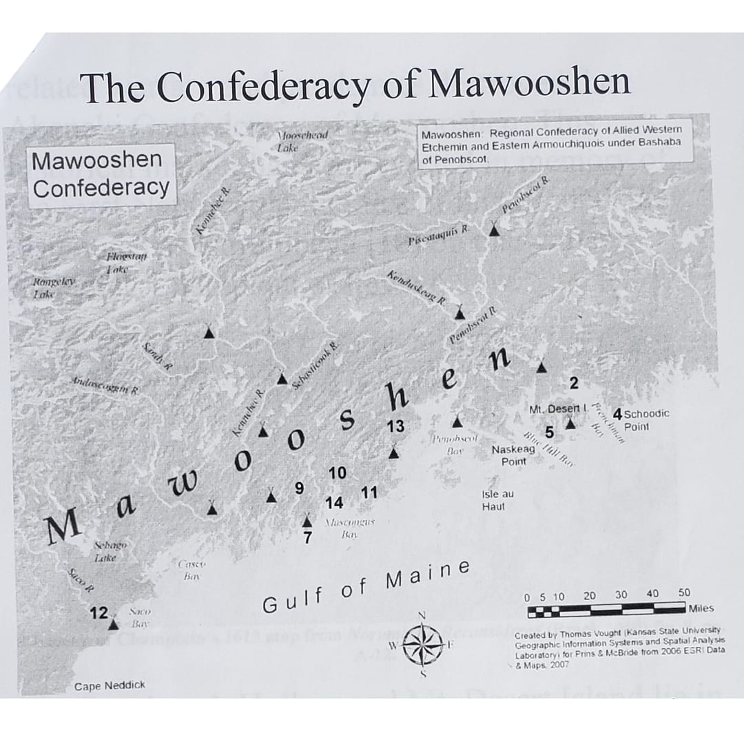
Map Title:
The Confederacy of Mawooshen – Allied Abenaki Communities in Coastal Maine
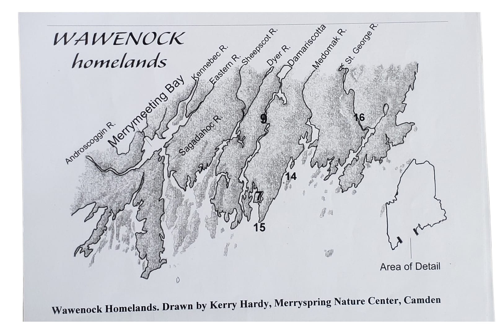
Key Historic Sites of the Wawenoc Confederacy
The following locations are referenced in early maps and accounts of the Wawenoc and their allies. These sites span the Norumbega bioregion and tell the story of First Nation travel, trade, settlement, and conflict throughout coastal Maine.
Below the map is a numbered site key. Each numbered entry corresponds to the historical maps used in this section.
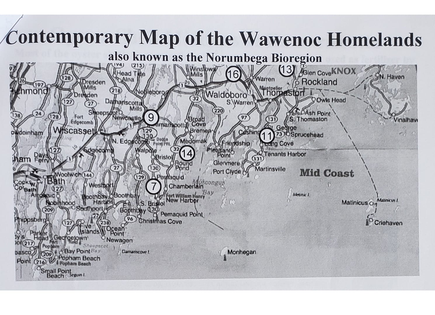
Map Title: Contemporary Map of the Wawenoc Homelands
Numbered Site Key
1. Breakneck Hollow – Hulls Cove
Historic site where the sculpture garden now stands. Located at the head of the cross-island trail.
2. Waukeag (now Sullivan and Sorrento)
A major First Nation community and departure point for shell-fishers crossing Frenchman Bay.
2a. Taft Point
Location of extensive Waukeag shell middens.
3. Cross-Island Trail
An overland route connecting Frenchman Bay with the island’s west side, used for trade and seasonal migration.
3a. Fernald Point – Southwest Harbor
End point of the western trail branch, and site of the French Saint Sauveur settlement.
3b. Manchester Point – Northeast Harbor
End of the eastern trail branch, used by First Nation travelers for access to shellfish-rich bays.
4. Schoodic Peninsula
Eastern boundary of the Mawooshen Confederacy and part of Wabanaki territory.
5. Fernald Point
Site of First Nation shell middens and later French colonial conflict.
6. Douaquet (Cadillac’s Land Grant)
A 100,000-acre French land grant in 1688 to Sieur Antoine de Lamothe Cadillac, covering Waukeag and Mount Desert Island.
7. Pemaquid Harbor
Location of Fort Pemaquid and the 1692 planned French attack that was betrayed by captured spies executed at Breakneck Hollow.
8. Somesville
First permanent English settlement on Mount Desert Island, established in 1761.
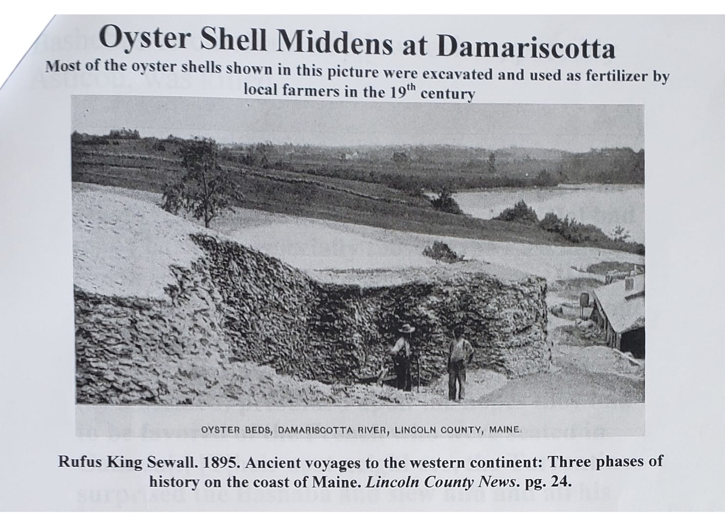
9. Damariscotta River
Site of massive oyster shell middens and a major pre-colonial Wawenoc settlement.
10. Norumbega
Theoretical capital of Mawooshen; often featured on early French and English maps.
11. St. Georges Harbor
Site of Captain George Waymouth’s 1605 kidnapping of five Wawenoc leaders.
12. Saco
Site of the 1607 Souriquois (Tarrentine) attack on the Abenaki, marking the beginning of Mawooshen’s downfall.
13. Hatchet Mountain – Hope, ME
Battle site in 1615 where the last known Bashaaba of Mawooshen was killed.
14. Muscongus Island
Home and burial site of Wawenoc leader Samoset, who helped early Plymouth settlers.
15. Wawenoc Homelands (Norumbega Bioregion)
Broad region between the Penobscot and Kennebec Rivers, rich in resources and culture.
16. Arambec – Warren, ME
Likely location of the largest Wawenoc settlement, on a loop of the St. Georges River.
Sources & Historic Maps
The history of the Wawenoc people and the Confederacy of Mawooshen has been pieced together through early European accounts, archaeological studies, oral traditions, and maps. Below is more information, including select quotes, historical notes, and maps that support and expand upon the Key Sites listed above.
Historic Map: Champlain’s 1613 Map of Norumbega
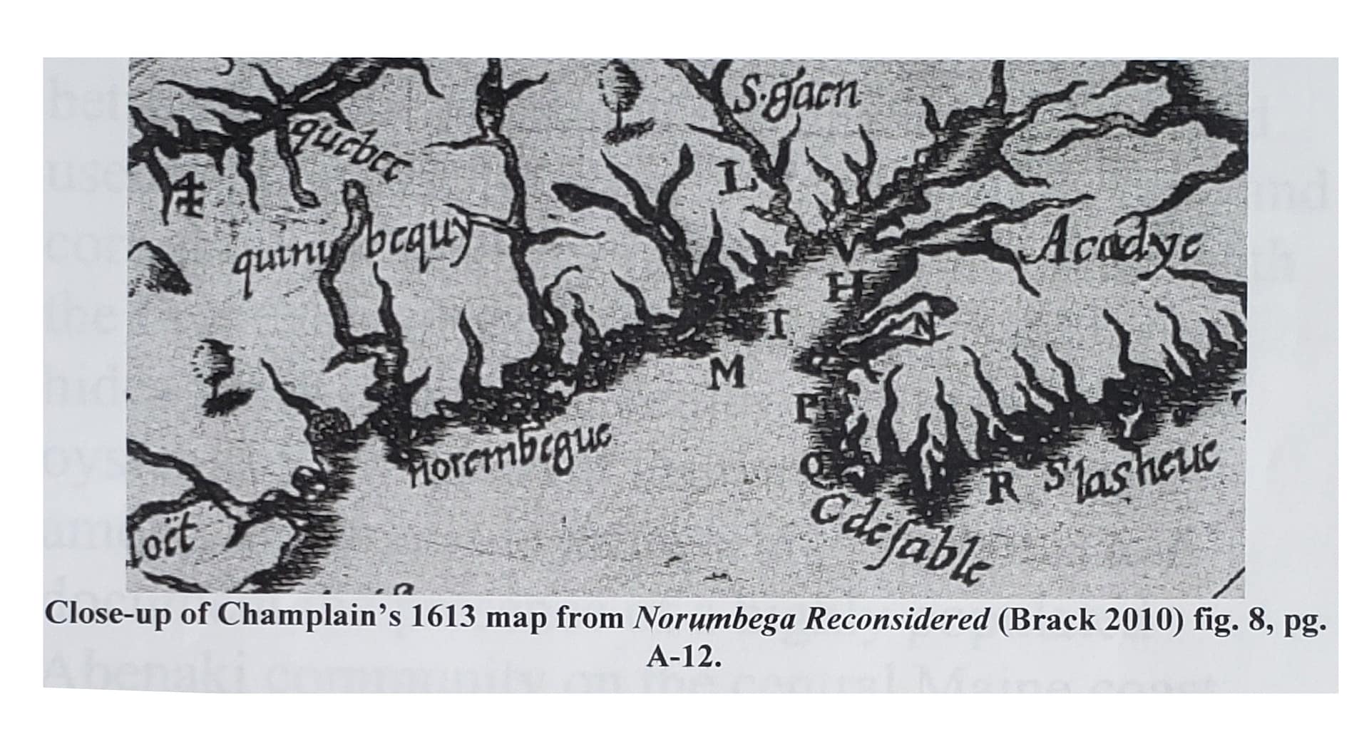
Close-up of Champlain’s 1613 map, showing Norumbega and surrounding territory. From “Norumbega Reconsidered” (Brack 2010), Fig. 8, p. 8.
Excerpt from Purchas (1625):
“Bessebes[,] had under him many great Sagamores… [He] had fifteen hundred Bow-Men… The War grew more and more violent between the Bashaabas and the Tarrentines, who presumed upon the hopes they had to be favored of the French… The Tarrentines surprised the Bashaabas and slew him and all of his people near about him.”
Context:
Refers to the Battle of Hatchet Mountain (Site 13) and the fall of the last Bashaaba, as recorded by Ferdinando Gorges based on testimony from kidnapped Wawenocs in 1605.
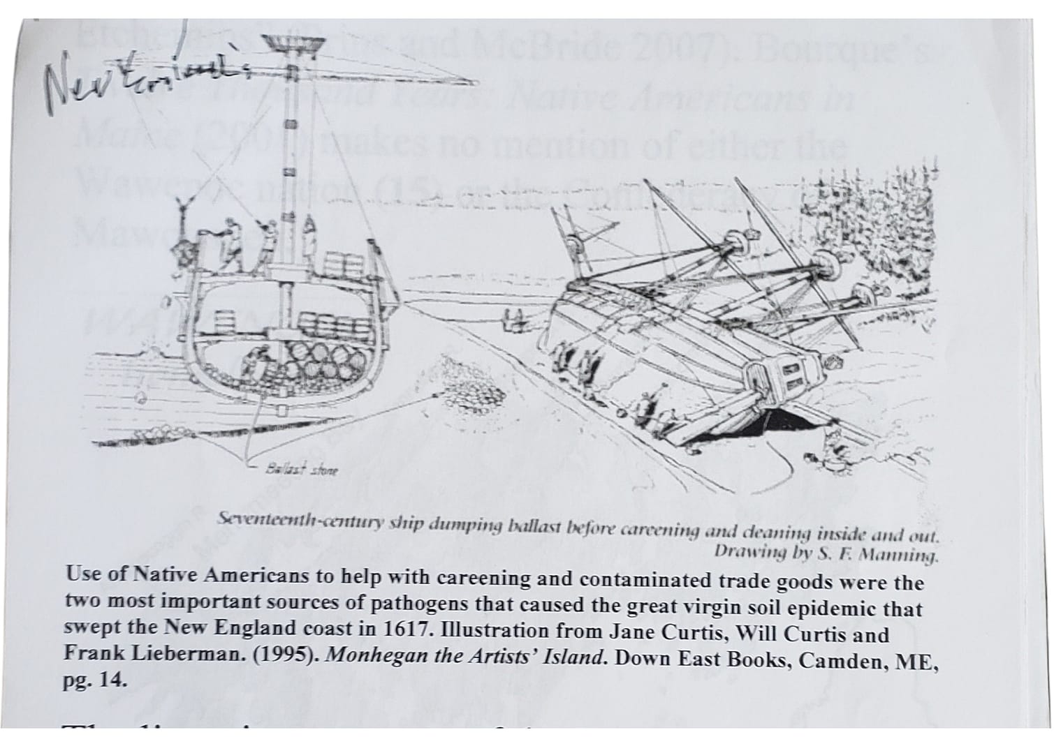
Illustration: Wabanaki Ship & Camp Scene
Stereotypical Wabanaki ship unloading ballast and setting up camp. Illustration from S.F. drawing, referenced in Lieberman (1995), “Monhegan the Artists,” Island Down East Books, Camden.
Map: Wawenoc Homelands (by Kerry Hardy)
Map of the Wawenoc homelands (Norumbega Bioregion), drawn by Kerry Hardy for the Merrymeeting Nature Center.
Map: Penobscot Tribal Boundaries (Speck 1928)
Penobscot tribe map based on Speck (1928) and additional data from “Norumbega Reconsidered,” Fig. A-26.
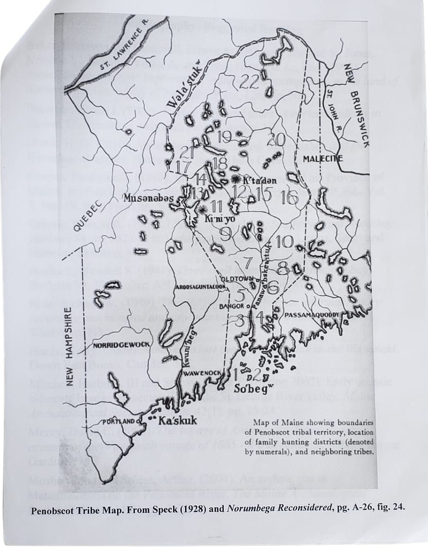
Photo: Damariscotta Oyster Shell Middens
Oyster shell middens at Damariscotta River (Site 9). Most shells were removed for fertilizer by 19th-century farmers.
Primary Sources & References
- Champlain, Samuel (1613)
- Purchas, Samuel (1625)
- Rosier, James (1605)
- Gorges, Ferdinando (1622–1647)
- Speck, Frank G. (1928)
- Hardy, Kerry. (2009). Notes on a Lost Flute
- Brack, Skip. (2010). Norumbega Reconsidered
- McBride & Prins. (2007). Confederacy of Mawooshen map work
